your way ...
MAIN MENU
your way ...
4x4 Car Hire & Camping

Learn a bit about this wonderful country before your arrival with our general information brief.
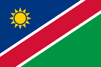
| Official Name: | Republic of Namibia |
| Population: | 2 114 161 (est 2010) |
| Capital City: | Windhoek (pop. 268 132 |
| Currency: | Namibian Dollar |
| Languages: | English 7% (official), Afrikaans 60%, German 32%, and numerous tribal dialects |
| Religions: | Christian (80%), Indigenous beliefs (20%) |
| Coastline: | 1,572km |
| Land area: | 824 290 sq km (318 260 sq miles) |
| Highest Point: | Brandberg (Konigstein) - 8550ft (2,606m) |
| Lowest Point: | Atlantic Ocean - 0ft (0m) |
| Land Divisions: | 14 Regions: Kunene, Omusati, Oshana, Ohangwena, Oshikogo, Kavango West, Kavango East, Zambezi, Erongo, Otjozondjupa, Omaheke, Khomas, Hardap, ||Karas |
| Latitude / Longitude: | 22° 34´S, 17° 06´E |
| Arable land: | 1% |
| Agriculture: | millet, sorghum, peanuts, grapes, livestock, fish |
| Industries: | Meatpacking, Fish processing, Dairy products; Mining (diamonds, lead, zinc, tin, silver, tungsten, uranium, copper). |
| Natural Resources: | Diamonds, copper, uranium, gold, lead, tin, lithium, cadmium, zinc, salt, vanadium, natural gas, oil, hydropower, fish. |
| Exports | Diamonds, copper, gold, zinc, lead, uranium; meat, processed fish, karakul skins |
| Imports | Foodstuffs, petroleum products and fuel, machinery and equipment, chemicals |
Namibia is bordered on the north by Angola and Zambia, on the east by Botswana, and on the east and south by South Africa. It is for the most part a portion of the high plateau of southern Africa, with a general elevation of from 3,000 to 4,000 ft.
The climate of Namibia is best described by its summer and winter conditions.
Winter days (May through September) are normally quite warm, but rather cold in the evenings and early mornings, especially June/July/August.
Summer days (October through April) are significantly hotter, with occasional heavy rains, January to March.
Privacy Policy | Disclaimer | Resources | © BlueCrane Web Development 2026